Place guide
Karma Waters and the upper Mitchell River
A place guide to a Western Yalanji cattle station on the Mitchell River, inland from Mount Carbine
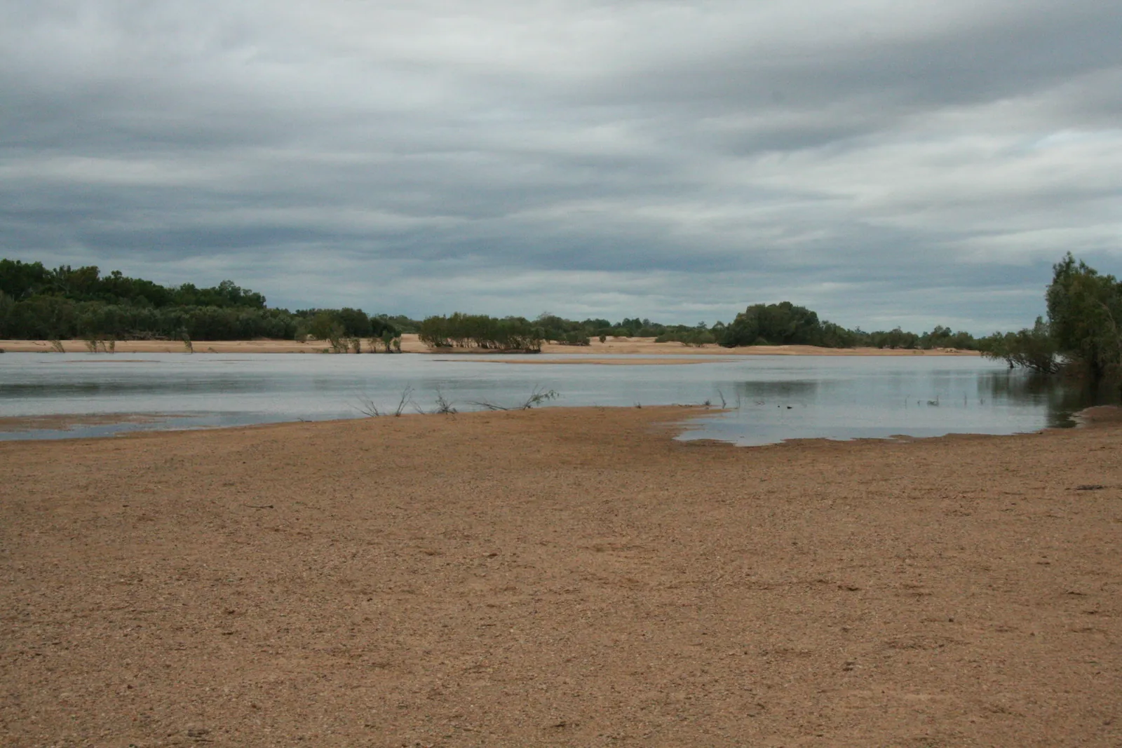

Karma Waters is a family-owned cattle station of about 45,000 ha on the northern side of the Mitchell River, about 200 km north-west of Cairns by road through Mount Carbine[1]. It is Western Yalanji country, the 'Sunset' side of Kuku Yalanji, west of the Great Dividing Range[2], and it is where Australia's first consent determination of native title over a pastoral property was made, in 1998[3]. The country is dry open woodland on shaly and greywacke ridges[1], cut by a sandy, paperbark-lined river that keeps flowing through the dry season in most years[4][5]. Freshwater crocodiles, black bream and freshwater prawns live in the river[6]. The station's nine bush campsites are open from 1 April to 30 November[6].
What you'll find here
In the river and its pools
Freshwater crocodiles, black bream (sooty grunter), catfish and northern yellow-faced turtles are all recorded close to the homestead. Barramundi are part of the Mitchell system but uncommon this far up.
Along the banks
The paperbark fringe and sandy banks of the Mitchell and St George.
In the open woodland
Ironbark and box woodland on the shale and greywacke ridges.
Things made and used
Mostly described from Bloomfield and middle-Palmer records; ask Western Yalanji people how they apply here.
Skills to learn here
Ways of fishing, hunting, carrying and preparing food, recorded mostly on the Bloomfield, the Palmer and the Laura. Ask Western Yalanji people how they were done on this river.
- Fish traps and weirs wukurrilSkills & methods
- Hooks and lines badurSkills & methods
- Fishing nets makarrSkills & methods
- Fish poisoning miyilSkills & methods
- String, twine and rope karraSkills & methods
- Dilly bags baljiSkills & methods
- Leaching poisonous plant foods ngabalSkills & methods
- Hunting with fire ngalkuSkills & methods
Rare or absent here
Entries you may wonder about at Karma Waters. Saltwater crocodiles are very unlikely this far up the Mitchell, and eels are rare to absent.
The station and getting there
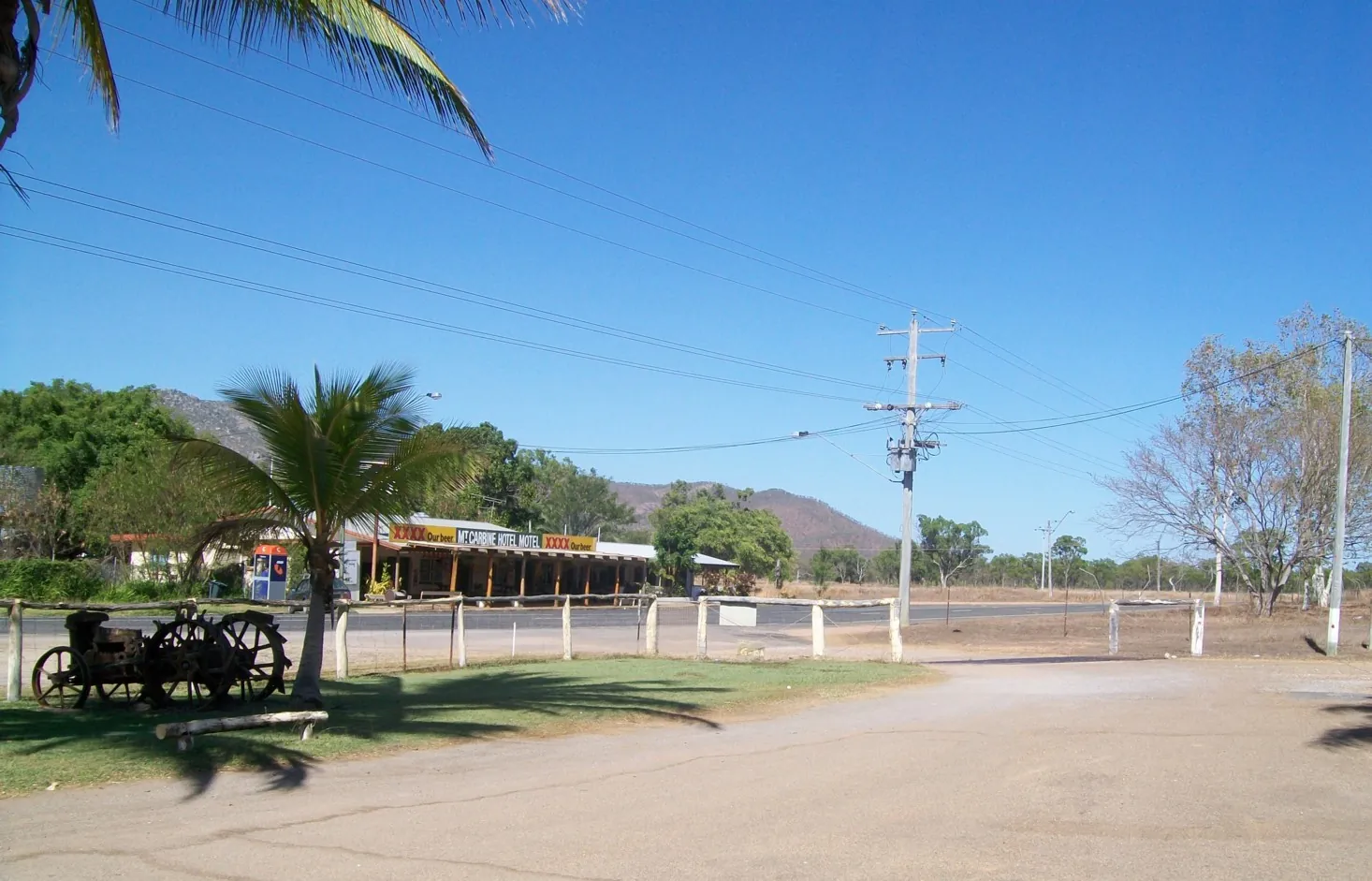
Karma Waters lies on the northern side of the Mitchell River. The turn-off is on the Mulligan Highway about 25 km west of Mount Carbine, and the way in follows Hurricane Road and then Karma Waters Road[1]. That last stretch is about 45 km of gravel with gullies, and the station does not take caravans[6]. Mount Carbine itself is about 133 km by road from Cairns and 70 km from Mareeba[7]. The homestead stands at about 16.62° S, 144.60° E, in the Hurricane locality of the Shire of Mareeba[8].
The station. Alan and Karen Pedersen built Karma Waters from two blocks. The hilly block north of the St George River was won in a land ballot in 1989. The second, bought in 1991, is about 10 km wide with 50 km of frontage to the Mitchell, and the homestead stands on it. Both blocks were bare of cattle and infrastructure. The name joins 'karma', for luck, to the waters of the Mitchell and the St George[1]. The station runs about 1,600 Brahman-cross cattle and musters twice a year, in May and September, with stockmen on horseback and helicopters[9]. In 1992 it fenced 45 km of the Mitchell to keep stock out of the river, and built 15 dams to water them instead[10].
Camping. There are nine basic bush campsites on the river. Bring everything: a portable toilet ('NO TOILET NO CAMPING'), your own drinking water and a first-aid kit. Arrive between 11 am and 5 pm and leave before 11 am. Everyone checks in at the homestead and signs an induction and waiver, even if they booked and paid online. Fees are $40 per vehicle per night, and bookings for each year open online at 7 am on 1 January[6][11]. Pets are welcome. Motorbikes, quads, weapons and hunting dogs are not[6]. Stay at your designated site, leave gates as you find them, and take all your rubbish out with you: the station says do not burn it[11].
Western Yalanji country and native title
'Western Yalanji' is the name of a language and of the people who speak it in the wider Maytown, Mitchell and Palmer River area. The language is a dialect of Kuku Yalanji. The Great Dividing Range is the general boundary between Eastern Yalanji country on the coast side and Western Yalanji country west of it, and the western people are also known as 'Sunset', 'Maytown' or 'inland' Yalanji[2]. The Western Yalanji are 10 clan estates and 26 family groups whose country runs from the headwaters of the Palmer and Mitchell Rivers to the lands around Laura. The split into 'Western' and 'Eastern' is a modern, practical one, not a customary one, and Yalanji people relate closely across a large part of Cape York Peninsula[3]. The dictionary's word for 'sunset' is [wungar daray](word:wungar daray)[12].
Which determination covers Karma Waters? The station's own determination came first. Western Yalanji or 'Sunset' Peoples v Alan & Karen Pedersen & Ors (QCD1998/001) was made by Drummond J on 28 September 1998[13] over land and waters near Mt Carbine in the Mareeba Shire, about 155 km north-west of Cairns. It was the first consent determination of native title over a pastoral property in Australia[3]. The station says the agreement took seven years to negotiate, and that it allowed the lease to be upgraded to an all-purpose perpetual lease[1]. A later Indigenous Land Use Agreement between the Western Yalanji and the Pedersens (QI2003/055, registered in 2005) lets that perpetual lease be extended over more land[3]. In 2006 a second consent determination, Riley v State of Queensland, recognised Western Yalanji native title over adjoining country. It was made at Mount Carbine, and the Pedersens were parties to it[13].
The better-known determinations lie further north. The two 2013 determinations, Brady on behalf of the Western Yalanji People #4 [2013] FCA 958 and the combined #5 and #7, cover country in and around the Palmer and Mitchell River systems north-west of Mt Carbine. Their areas run from the southern boundary of Cook Shire north to the Palmer River, taking in parts of the Mount Mulgrave, Palmerville and Maitland Downs leases, Granite Creek and the Palmer Goldfields reserve[2]. The August 2026 Cape York United #1 determination, Ross ... (No 42) (Western Yalanji determination) [2026] FCA 1084, made on 14 August 2026, covers the south-east corner of the Cape York United claim. Its boundary follows the Palmer River, the Great Dividing Range and the southern boundary of the Cape York representative body area[14], over 170,827 ha[15]. Karma Waters, on the Mitchell in Mareeba Shire, falls under neither. Its native title is the 1998 one. (We matched these by their published descriptions and maps, not by checking the 1998 lot plans.)
All the Western Yalanji determinations are held for the native title holders by the Western Yalanji Aboriginal Corporation RNTBC. It is also the registered Aboriginal cultural heritage body for Western Kuku Yalanji country, and its office is in Mareeba[3][2][14].
Neighbours. The Muluridji, whose Kuku Yalanji dialect is also called Muluridji, hold native title near Mareeba[16]. Tindale mapped their country from the headwaters of the Mitchell north as far as Mount Carbine[17]. In evidence for the 2026 determination, a Western Yalanji man named Djungan country to the south and Eastern Kuku Yalanji to the east. He also put the south-western corner of Western Yalanji country at the junction of the Palmer and the Mitchell, and its southern edge at the north side of Rifle Creek[14].
The river
The Mitchell, a wawubaja 'river'[12], rises on the Atherton Tableland about 50 km north-west of Cairns. It runs about 750 km north-west across Cape York Peninsula to the Gulf of Carpentaria, north of Kowanyama. Its catchment covers about 71,757 km², and it carries more water to the sea than any other river in Queensland[18]. At Karma Waters it is still an upper-catchment river. The St George River, one of its tributaries, runs through the north of the Hurricane locality, and the Hodgkinson River flows through its eastern part[8].
Rock and sand. This is not granite country. The station's ridges are shale and greywacke[1]. They belong to the Hodgkinson Formation, metamorphosed sediments of greywacke, siltstone, shale and slate laid down between the Ordovician and the Devonian. The same rocks hold the tungsten veins at Mount Carbine[19]. (Granite and volcanic rock do occur in the eastern third of the Mitchell catchment[5].) Along the banks runs a fringe of paperbarks: Melaleuca fluviatilis, weeping teatree and silver-leafed paperbark, with river red gum, bluegum and Leichhardt trees. The ground beneath them is often bare jukar, 'sand'[12], with leaf litter. This fringing forest grows on the stream banks and channels of the western-flowing rivers that drain the Hodgkinson Basin. It is a drought refuge and wildlife corridor, and rubber vine invades it easily[4].
Wet and dry. The main channel of the Mitchell flows all year in most years. Its tributaries the Palmer and the Walsh often stop flowing in the dry season and break into a chain of separate pools. As the dry season goes on and the water shrinks back, fish come to depend on the food available in their own pool[5]. In the wet, all the rivers flow and the system joins up again. Barramundi that get into fresh water in the wet season grow faster than those that stay on the coast, and wetter years with bigger flows mean more and bigger barramundi[5].
Seasons
There are two seasons here, and the gap between them is huge. Across the Mitchell catchment, on average only 4% of the year's rain falls between May and October[5]. There is no weather station at Karma Waters. The nearest long record inland is at Palmerville, about 90 km north-west on the Palmer, which has kept records since the 1880s. There, about 1,040 mm of rain falls in a year, and more than four-fifths of it comes from December to March. In July, August and September the median rainfall is close to zero. Mean maximums climb from about 30 °C in June and July to 35.6 °C in October and 36.2 °C in November. July nights average about 14 °C[20]. Mareeba Airport, about 100 km south-east and up on the tableland at 472 m, is a few degrees cooler and has a similar pattern: 894 mm a year, falling mostly from December to March[21].
The station's year. All recreation access closes from 1 December to 1 April. The closure stops erosion on the access roads and gives fish and prawns a spawning season without disturbance[6]. Cattle are mustered in May and September. The bulls go out in September and back to the breeders in early February, so calves drop at the right time of year[9]. Most of the country is burnt every three to four years, depending on the season, to clear excess fuel, which the station notes has been part of looking after this country for thousands of years[10].
On the river. Freshwater crocodiles court at the start of the dry season and lay their eggs in August and September, in holes dug in sandbanks usually within 10 m of the water. The eggs hatch two to three months later, and the mother digs out the young and guards them for a while (these figures come from studies in the Northern Territory)[22]. So from August to the early wet, keep off the sandbanks where crocodiles have been digging. The barramundi closed season starts on 7 October[23].
Season words. The dictionary gives kambar 'wet season', wangariji 'the hot season', kiway 'cold', kaba 'rain', jalungkarr 'flood' and jarramali 'thunder, thunderstorm, thunderheads'. Two entries point west: jabulbina is 'thunder out west, the start of all storms', and jabalbina is noted as the 'Maytown language for storm'[12]. Most of the dictionary's place names are on the Bloomfield and Daintree side[12], and we found no published Western Yalanji seasonal calendar. Western Yalanji people are the ones to ask how the year is read on this country.
What lives here, and what doesn't
The Atlas of Living Australia holds about 4,000 records from within 30 km of the homestead[24]. These are the highlights.
- Trees of the woodland: Cullen's ironbark (Eucalyptus cullenii), Molloy red box (E. leptophleba), river red gum, bloodwoods (Corymbia), grevilleas, wattles and paperbarks including Melaleuca viridiflora[24].
- In the river: freshwater crocodile, sooty grunter (the station's black bream), Gulf saratoga, spangled perch, barred grunter, bony bream, sleepy cod, rainbowfish, Hyrtl's and black catfish, redclaw crayfish and the northern yellow-faced turtle. The Arafura file snake hunts in the pools[24]. The station adds the 'Mitchell River prawn or cherapin'[6]; the dictionary's wukuju is 'freshwater prawn, the big one with long legs'[12]. Freshwater mussels (Velesunio angasi) were collected about 9 km east of the homestead, up the river, in 1916[25].
- Birds: squatter pigeons, with over 50 records, plus Gouldian finches, great bowerbirds, apostlebirds, Australian bustards, brolgas and sarus cranes, comb-crested jacanas, darters and red-tailed black cockatoos[24]. The squatter pigeon is listed as vulnerable under both Commonwealth and Queensland law[3].
- Mammals: agile wallabies, common and antilopine wallaroos, the Mareeba rock-wallaby, echidnas and several kinds of bat[24]. The station reports 'a huge increase in kangaroos and wallaroos' since it began controlling wild dogs[10].
- Introduced: cane toads, feral pigs, cats and wild cattle[24][26]. The station's target weeds are rubber vine, giant rat's tail grass, Wynn cassia, devil's claw and calotrope[10].
What does not live here. The encyclopedia was written mostly from Bloomfield and Daintree sources, so many of its entries belong to the rainforest and the coast. Cassowaries, scrubfowl, black palm, red cedar, candlenut, lawyer cane, stinging trees and black bean belong to the rainforest of the ranges to the east. Mud crabs and sea turtles belong to the coast. The Atlas holds none of them within 30 km of the homestead[24]. Eels are rare to absent on this part of the Mitchell, and saltwater crocodiles are not normally here (see Staying safe).
Old records from the Mitchell. The nearest Kuku Yalanji records Roth made inland come from Butcher's Hill (Boggy Creek), far to the north[27], and from the middle Palmer[28]. Edward Palmer's notes on the Mitchell River (the reach is not stated) say that the fruit of Capparis lasiantha was eaten, and that the green fruit of Luffa aegyptiaca was used to poison fish[27]. Both plants have been recorded within 30 km of the homestead[24]. These are historical records, not things to try. Western Yalanji people hold the living knowledge of this country's foods.
Fishing and the law
The Mitchell flows to the Gulf, so Gulf of Carpentaria fresh-water rules apply. These are Queensland's rules for recreational fishers.
- Barramundi closed season: 7 October to 31 January every year, in all Gulf fresh waters except a few listed impoundments. During the closure you cannot target barramundi at all, even for catch-and-release, because the stress of capture can stop a fish spawning[23]. (The east-coast closure, 1 November to 31 January, does not apply here.) The government page gives the dates but no times of day[23].
- Barramundi in season: 58 to 120 cm. Limit 5 per person, or 10 per boat with two or more people aboard[29]. Barramundi are part of the Mitchell system, but the Atlas holds no barramundi records within 30 km of the homestead[24].
- Black bream (sooty grunter): at least 28 cm. There is a combined limit of 10 for Gulf, khaki, lake and sooty grunter[29].
- Saratoga (northern, the Gulf saratoga): at least 50 cm, limit 1[29].
- Catfish: eel-tailed catfish (Tandanus) at least 35 cm. Other freshwater catfish, such as Neosilurus, have no size limit. The combined limit for all freshwater catfish is 5[29].
- Cherabin (Macrobrachium lar and M. rosenbergii): no size limit, combined limit 10. Redclaw (this is their natural range): limit 40, and females carrying eggs or young must go back[29]. Museum specimens of freshwater prawns from the upper Mitchell near Mount Carbine are the smaller M. australiense[30]. For any fresh-water species not on the list, a general possession limit of 20 applies, and your possession limit includes fish in the freezer[29].
- Gear: up to 6 lines, each with a single hook or lure, and you must stay within 50 m of them. No set lines. No spears, spear guns, cast nets, seine nets or crab pots in fresh water. You may use up to 4 traps of the permitted kinds, each tagged with your name and address. West of the Great Dividing Range, which includes the Mitchell, funnel traps may have openings up to 10 cm[31].
Freshwater crocodiles and turtles are not fish. They are protected native animals, and taking them needs a licence or permit[32].
Traditional fishing. Under section 211 of the Native Title Act 1993, native title holders fishing, hunting or gathering for personal, domestic or non-commercial communal needs do not need the licences and permits other people need[33]. Queensland's Fisheries Act 1994 recognises traditional fishing on the same basis[34].
Staying safe
Freshwater crocodiles live in this river. The station says so plainly[6]. The Atlas holds records from 2023 and 2004 about 8 km and 11 km from the homestead, and more up and down the Mitchell[35]. The freshwater crocodile, ngawurr-ngawun[12], is usually shy and quick to flee. But a swimmer who bumps into one underwater can be bitten, and a bite from a big one causes deep punctures that can take months to heal. A threatened crocodile puffs up, shudders and growls before it snaps. Females guard their newly hatched young[22]. Don't swim where you can't see the bottom, and keep away from nests and hatchlings.
Saltwater crocodiles. Queensland's crocodile country takes in the Gulf rivers. Estuarine crocodiles can turn up in any waterway there and can travel hundreds of kilometres[36]. Queensland's habitat model puts their inland limit at the 200 m contour[37]. The Atlas holds no saltwater crocodile records within 30 km of Karma Waters. Within 60 km there are only two unverified sighting reports near Mount Carbine, from 2015 and 2019, and two old museum specimens with rough coordinates well to the south-west[35]. So bilngkumu[12] is very unlikely here, but not impossible. Follow the Be Crocwise basics anyway: stay back from the edge, never leave fish scraps or bait at the water's edge, and take extra care at dawn, dusk and night[36].
Heat and water. October to December is the hot end of the year, with average maximums around 35–36 °C at Palmerville[20]. Bring all your own water[11].
Remoteness. The track in is 45 km of gravel and gullies[6]. The station's induction lists UHF channel 3 for two-way radio, says the homestead telephone is for emergencies only, and requires every camper to carry a personal first-aid kit. Report any injury to the managers and drive to the conditions[11]. We found no reliable published report of mobile coverage at the campsites, so plan as if you will have none.
Animals and baits. Don't approach the cattle, horses or feral animals[11]. Helicopters may be working wild cattle along the river during musters[26][9]. The station baits wild dogs about twice a year, with strychnine in the wet season and 1080 later in the year[10]. The baits are laid to kill dogs, so keep yours close and ask at the homestead where baits are out. Coastal taipans and mulga snakes (king browns) have been recorded within 30 km[24].
Fire. Campfires are restricted to your campsite[11]. In Queensland a fire smaller than 2 m in every direction may be lit without a permit if you take adequate precautions, but no fire may be lit during a fire ban[38]. Ngalku is 'bush fire'[12].
Hunting, gathering and permission
Whose rights. The 1998 determination recognised Western Yalanji rights over this country, held alongside the lease and 'not to the exclusion of all others'. They include the right to live on, camp on and travel across the land, and, subject to customary protocol, to permit other people to do so. They also include the right to use the area and its natural resources for social, cultural, economic, religious, spiritual, customary and traditional purposes; to allow others to use those resources; to build structures; to preserve significant sites; and to hold cultural activities. These rights are exercised under traditional law and under Commonwealth, State and local law[3]. Section 211 of the Native Title Act 1993 protects native title holders' hunting, fishing and gathering for personal, domestic or non-commercial communal needs from licence and permit requirements[33].
The 2013 and 2026 orders. The 2013 determinations to the north spell out two limits. Native title holders may 'light fires on the area for domestic purposes including cooking, but not for the purpose of hunting or clearing vegetation'. Hunting with firearms on a pastoral lease may happen only where stock are not present, and only after the lessee or manager has had enough notice to deal with safety[2]. The 2026 determination allows fires 'for cultural, spiritual or domestic purposes including cooking, but not for the purpose of hunting or clearing vegetation'[14]. Those orders cover their own areas, not Karma Waters. The published summary of the 1998 determination includes no such clauses, but we have not seen the full 1998 orders.
For visitors. Camping at Karma Waters is by the station's leave and on the station's rules: no weapons, no hunting dogs, and stay at your designated campsite[6][11]. Hunting, gathering bush foods, cutting wood, digging ochre or collecting stone go beyond that. Before doing any of them, ask the Traditional Owners through the Western Yalanji Aboriginal Corporation in Mareeba, as well as the station[3]. Native animals and many plants are protected in Queensland, and anyone without native title rights needs a licence or permit to take them[32]. In their own community plan, Western Yalanji people say they are worried about heritage sites being damaged by tourists and cattle, and they want 'our water and sacred sites respected by visitors and tourists'[3].
Places of significance. There are places of significance on Western Yalanji country, and this guide does not name or locate them. If you come across painted rock, stone tools, scarred trees or anything else that looks made by people, leave it where it is and tell the station and the Traditional Owners. Queensland law makes it an offence to harm Aboriginal cultural heritage, and gives everyone a duty of care not to[39].
History
Deep time. Archaeological work shows that Aboriginal people have lived in the Maytown, Mitchell and Palmer River region for at least 21,000 years. Cave paintings and tools are among the evidence[2].
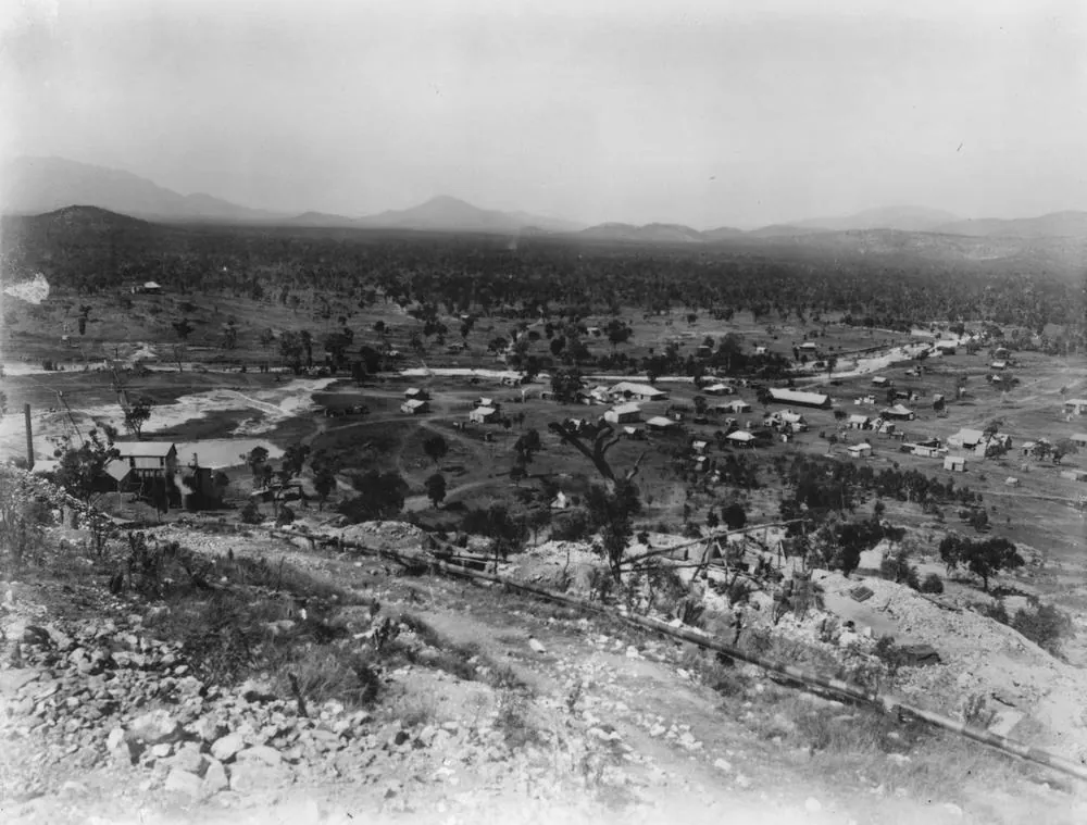
Gold. Explorers' records from 1872–74, among them those of William Hann and James Venture Mulligan, show this country as fully Aboriginal, unchanged by pastoralists or epidemic[13]. Hann's party found gold on the Palmer in 1872. The rush began in 1873, and the party that cut the road in from Cooktown that year shot Aboriginal people along the way. More than 20,000 Chinese miners came to the Palmer between 1874 and 1877[40]. In 1876 Mulligan found gold on the Hodgkinson River, much closer to Karma Waters. Miners moved there from the Palmer, and the ports of Cairns and Port Douglas grew up to serve the new field[41]. The Western Yalanji plan counts the Palmer rush (1873–1885) as the event that brought in roads, money and the cattle industry, which stayed[3].
The frontier. The anthropologist's report in the 2006 determination records that the first Western Yalanji people 'came in' in 1888, a group of 25. Hostilities ended in the 1890s, and the 'density of the records of frontier violence' from that time points to a sizeable population that kept clearly defined connections to its land[13]. The Court found that Yalanji knowledge and language went on being passed down through the 20th century[2].
Tungsten. Mount Carbine is said to be named after Carbine, the horse that won the 1890 Melbourne Cup, the year wolfram (tungsten ore) was found there. Mining grew from 1907 and stopped in 1914. It started again after the First World War and ran on and off, then revived from the late 1960s for about twenty years before closing in the 1980s[7]. The Mt Carbine deposit was the largest vein-type tungsten deposit in Australia, and in 1986 it produced 43% of the country's tungsten[19].
The station and the agreement. Karma Waters was put together from a 1989 ballot block and a 1991 purchase. The 1998 consent determination made it the first pastoral property in Australia with a consent determination of native title[1][3]. SBS's Indigenous Media Unit made a 30-minute documentary about it, Karma Waters Land Agreement (2000), directed by Lorna O'Shane[42].
Images


References
- Karma Waters Station. About: location, native title (web page, accessed 5 October 2026). www.karmawatersstation.com/about.html
- Brady on behalf of the Western Yalanji People #4 v State of Queensland [2013] FCA 958 (Logan J, 24 September 2013), with Brady on behalf of the Western Yalanji People Combined #5 and #7. — Orders 6–11 and Schedule 1 (both determinations); reasons [3], [20]–[24] www.judgments.fedcourt.gov.au/judgments/Judgments/fca/single/2013/2013fca0958
- Western Yalanji Aboriginal Corporation & CRC for Developing Northern Australia (2020). Western Yalanji Land Use and Economic Diversification Plan. CC BY 4.0. — Western Yalanji story; historical timeline (Table 1); Native Title Determinations 1–4; ILUAs (Table 4); pastoral stations (Table 5); heritage sites crcna.com.au/wp-content/uploads/2024/05/westernyalanjilanduseplan_nov2020.pdf
- Queensland Herbarium. Regional Ecosystem 9.3.14 (Einasleigh Uplands): Melaleuca fringing woodland on channels and levees. Regional Ecosystem Description Database. apps.des.qld.gov.au/regional-ecosystems/details/?re=9.3.14
- Stewart-Koster, B., O'Mara, K., et al. (2021). Critical water needs to sustain freshwater ecosystems and aquatic biodiversity in Queensland's Mitchell River. Griffith University. — Executive summary (wet and dry season models); sect. 2 (catchment, hydrology) era.dpi.qld.gov.au/id/eprint/8432/1/Critical-water-needs-for-the-Mitchell-River-final-report.pdf
- Karma Waters Station. Bush Camping at Karma Waters Station (web page, accessed 5 October 2026). www.karmawatersstation.com/bush-camping.html
- Wikipedia. Mount Carbine, Queensland (accessed 5 October 2026). en.wikipedia.org/wiki/Mount_Carbine,_Queensland
- Wikipedia. Hurricane, Queensland (accessed 5 October 2026). en.wikipedia.org/wiki/Hurricane,_Queensland
- Karma Waters Station. Cattle (web page, accessed 5 October 2026). www.karmawatersstation.com/cattle.html
- Karma Waters Station. Land management (web page, accessed 5 October 2026). www.karmawatersstation.com/land-management.html
- Karma Waters Station. Induction, waiver and indemnity form (updated 9 June 2023). www.karmawatersstation.com/uploads/3/1/9/2/31929385/induction_waiver_and_indemnity.pdf
- Hershberger, H. D. & Hershberger, R. (1982). Kuku-Yalanji Dictionary. Work Papers of SIL-AAB, Series B, Volume 7. With Toby Bloomfield, Roy Friday, Billy Roberts, Hector and Doris Sykes, Joe Walker and others. www.sil.org/resources/archives/18038
- Riley v State of Queensland [2006] FCA 72 (Allsop J, 17 February 2006, made at Mount Carbine). — Parties; reasons [2], [19]–[21] www.judgments.fedcourt.gov.au/judgments/Judgments/fca/single/2006/2006fca0072
- Ross on behalf of the Cape York United #1 Claim Group v State of Queensland (No 42) (Western Yalanji determination) [2026] FCA 1084 (Mortimer CJ, 14 August 2026). — Order on native title rights (fires); Schedule 3 external boundary; reasons [4], [7]–[8], [45] www.judgments.fedcourt.gov.au/judgments/Judgments/fca/single/2026/2026fca1084
- National Indigenous Times (13 August 2026). 'Western Yalanji determination brings Cape York native title to the finish line.' nit.com.au/13-08-2026/25941/western-yalanji-determination-brings-cape-york-native-title-to-the-finish-line
- Baker on behalf of the Muluridji People #3 v State of Queensland (No 2) [2026] FCA 933 (Longbottom J). — Reasons [1], [4], [15] www.judgments.fedcourt.gov.au/judgments/Judgments/fca/single/2026/2026fca0933
- Wikipedia. Muluridji (after Tindale 1974, Aboriginal Tribes of Australia) (accessed 5 October 2026). en.wikipedia.org/wiki/Muluridji
- Wikipedia. Mitchell River (Queensland) (accessed 5 October 2026). en.wikipedia.org/wiki/Mitchell_River_(Queensland)
- Cheng, Y., Chang, Z. & Huizenga, J. (2017). Geology and mineralization of the Mt Carbine Tungsten Deposit, Northern Queensland, Australia. EGRU Contribution 69, James Cook University (abstract). researchonline.jcu.edu.au/54656/
- Bureau of Meteorology. Climate statistics for Australian locations: Palmerville (station 028004), records from 1889 (accessed 5 October 2026). www.bom.gov.au/climate/averages/tables/cw_028004.shtml
- Bureau of Meteorology. Climate statistics for Australian locations: Mareeba Airport (station 031210), 2000–2026 (accessed 5 October 2026). www.bom.gov.au/climate/averages/tables/cw_031210.shtml
- Australian Museum. Freshwater Crocodile, Crocodylus johnstoni (web page, accessed 5 October 2026). australian.museum/learn/animals/reptiles/freshwater-crocodile/
- Queensland Department of Primary Industries. Closed seasons in fresh waters: barramundi (web page, last updated 10 September 2025; accessed 5 October 2026). www.dpi.qld.gov.au/business-priorities/fisheries/closures/fresh/seasons
- Atlas of Living Australia. All occurrence records within 30 km of the Karma Waters homestead (16.618° S, 144.605° E), species facet, queried 5 October 2026 (4,053 records; 601 species). biocache.ala.org.au/occurrences/search?q=*:*&lat=-16.6179&lon=144.6047&radius=30
- Australian Museum specimen, Velesunio angasi, Mitchell River at about 16.65° S, 144.68° E, collected 1916. Atlas of Living Australia. biocache.ala.org.au/occurrences/5f751ec4-88f1-4b7f-be38-9d915a49c5ff
- Karma Waters Station. Outback Cuppa: transcript of a film of a muster on Karma Waters, with Alan, Karen and Ron Pedersen (web page, accessed 5 October 2026). www.karmawatersstation.com/outback-cuppa.html
- Roth, W. E. (1901). North Queensland Ethnography, Bulletin No. 3: Food — its search, capture, and preparation. Brisbane: Government Printer. — Abbreviations (B's H. = Butcher's Hill, Boggy Creek); plant-food list (Capparis lasiantha, after E. Palmer 1883); sect. 15(c) fish-poisons (Luffa aegyptiaca) archive.org/details/northqueensland00landgoog
- Roth, W. E. (1909). North Queensland Ethnography, Bulletin No. 13: Fighting weapons. Records of the Australian Museum 7(4). — Sect. 4, Middle Palmer River spears archive.org/details/biostor-52873
- Queensland Government. Size and possession limits in fresh waters (web page, last updated 27 March 2026; accessed 5 October 2026). www.qld.gov.au/recreation/activities/boating-fishing/rec-fishing/rules/limits-fresh
- Queensland Museum specimen, Macrobrachium australiense, upper Mitchell River at about 16.5° S, 145.0° E, collected 1997. Atlas of Living Australia. biocache.ala.org.au/occurrences/930809ca-9285-414d-baca-ac0f6e052179
- Queensland Government. Fishing equipment rules: fresh waters (web page, accessed 5 October 2026). www.qld.gov.au/recreation/activities/boating-fishing/rec-fishing/rules/equipment
- Queensland Government, State of the Environment. Nature Conservation Act 1992. www.stateoftheenvironment.des.qld.gov.au/biodiversity/management-responses/legislation/nature-conservation-act-1992
- Native Title Act 1993 (Cth), section 211: preservation of certain native title rights and interests (hunting, fishing and gathering for personal, domestic or non-commercial communal needs). www.legislation.gov.au/C2004A04665/latest/text
- Business Queensland. First Nations fishing (Fisheries Act 1994). www.business.qld.gov.au/industries/farms-fishing-forestry/fisheries/first-nations
- Atlas of Living Australia. Occurrence records of Crocodylus johnstoni and Crocodylus porosus within 30 km and 60 km of the Karma Waters homestead, queried 5 October 2026 (C. johnstoni: 4 within 30 km, 13 within 60 km; C. porosus: none within 30 km, 4 within 60 km). biocache.ala.org.au/occurrences/search?q=taxon_name%3A%22Crocodylus%20porosus%22&lat=-16.6179&lon=144.6047&radius=60
- Queensland Government. Be Crocwise top tips; Be Crocwise in Croc Country (web pages, accessed 5 October 2026). www.qld.gov.au/environment/plants-animals/animals/living-with/crocodiles/becrocwise/be-crocwise-top-tips
- Queensland Department of Environment. Estuarine crocodile population modelling, Appendix 8: defining estuarine crocodile habitat (inland limit set at the 200 m contour). environment.desi.qld.gov.au/__data/assets/pdf_file/0032/276773/appendix-8.pdf
- Queensland Fire Department. Fire permits: lighting fires in Queensland. fire.qld.gov.au/safety-education/using-fire-outdoors/lighting-fires-in-queensland
- Aboriginal Cultural Heritage Act 2003 (Qld), sections 23–25 (cultural heritage duty of care; harming, excavating, relocating or taking away Aboriginal cultural heritage). www.legislation.qld.gov.au/view/html/inforce/current/act-2003-079
- Wikipedia. Palmer River (history and Palmer River goldfields) (accessed 5 October 2026). en.wikipedia.org/wiki/Palmer_River
- Wikipedia. Hodgkinson Minerals Area (accessed 5 October 2026). en.wikipedia.org/wiki/Hodgkinson_Minerals_Area
- Screen Australia, The Screen Guide. Karma Waters Land Agreement (2000), dir. Lorna O'Shane, Indigenous Media Unit, SBS Television. www.screenaustralia.gov.au/the-screen-guide/t/Karma-Waters-Land-Agreement/23972